


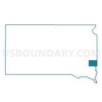
VTD VP10, Minnehaha County, South Dakota
About
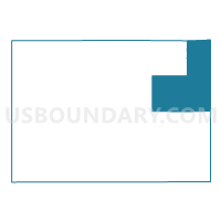
Outline

Summary
| Unique Area Identifier | 667582 |
| Name | VTD VP10 |
| County | Minnehaha County |
| State | South Dakota |
| Area (square miles) | 83.39 |
| Land Area (square miles) | 83.06 |
| Water Area (square miles) | 0.33 |
| % of Land Area | 99.60 |
| % of Water Area | 0.40 |
| Latitude of the Internal Point | 43.74072590 |
| Longtitude of the Internal Point | -96.53590110 |
Maps

Graphs
Select a template below for downloading or customizing gragh for VTD VP10, Minnehaha County, South Dakota


Neighbors
Neighoring Voting District (by Name) Neighboring Voting District on the Map
- Beaver Creek Twp. Voting District, Rock County, MN
- Eden Twp. Voting District, Pipestone County, MN
- Rose Dell Twp. Voting District, Rock County, MN
- Springwater Twp. Voting District, Rock County, MN
- VTD 21, Minnehaha County, SD
- VTD 3, Minnehaha County, SD
- VTD 4, Minnehaha County, SD
- VTD VP 01, Minnehaha County, SD
- VTD VP12, Minnehaha County, SD
- VTD VP9, Minnehaha County, SD
- VTD-precinct 3, Moody County, SD
Top 10 Neighboring County Subdivision (by Population) Neighboring County Subdivision on the Map
- Mapleton township, Minnehaha County, SD (2,188)
- Garretson city, Minnehaha County, SD (1,166)
- Sverdrup township, Minnehaha County, SD (809)
- Brandon township, Minnehaha County, SD (774)
- Dell Rapids township, Minnehaha County, SD (550)
- Edison township, Minnehaha County, SD (510)
- Beaver Creek township, Rock County, MN (386)
- Red Rock township, Minnehaha County, SD (363)
- Palisade township, Minnehaha County, SD (358)
- Eden township, Pipestone County, MN (278)
Top 10 Neighboring Place (by Population) Neighboring Place on the Map
Top 10 Neighboring Unified School District (by Population) Neighboring Unified School District on the Map
- Brandon Valley School District 49-2, SD (16,026)
- Pipestone Area School District, MN (7,718)
- Dell Rapids School District 49-3, SD (5,508)
- Garretson School District 49-4, SD (2,474)
- Hills-Beaver Creek School District, MN (2,049)
- Baltic School District 49-1, SD (1,967)
Top 10 Neighboring State Legislative District Lower Chamber (by Population) Neighboring State Legislative District Lower Chamber on the Map
- State House District 10, SD (35,025)
- State House District 22A, MN (34,781)
- State House District 25, SD (22,548)
- State House District 8, SD (20,647)
Top 10 Neighboring State Legislative District Upper Chamber (by Population) Neighboring State Legislative District Upper Chamber on the Map
- State Senate District 22, MN (71,339)
- State Senate District 10, SD (35,025)
- State Senate District 25, SD (22,548)
- State Senate District 8, SD (20,647)
Top 10 Neighboring 111th Congressional District (by Population) Neighboring 111th Congressional District on the Map
Top 10 Neighboring Census Tract (by Population) Neighboring Census Tract on the Map
- Census Tract 104.04, Minnehaha County, SD (4,656)
- Census Tract 101.01, Minnehaha County, SD (4,601)
- Census Tract 9596, Moody County, SD (3,313)
- Census Tract 5701, Rock County, MN (2,490)
- Census Tract 104.02, Minnehaha County, SD (2,474)
- Census Tract 4604, Pipestone County, MN (1,714)